

Guide to Bangkok Transit Map: BTS, MRT, ARL, SRT
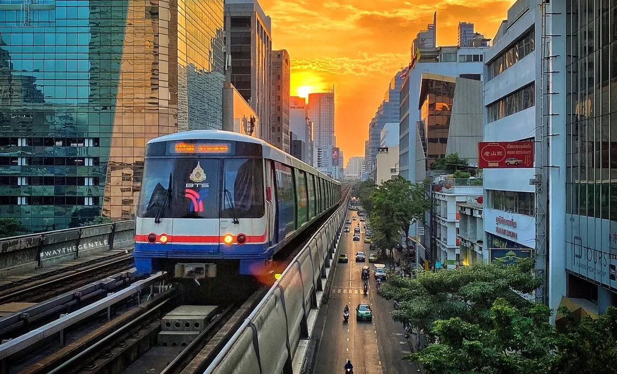

Bangkok is known for heavy road congestion, and rail-based transport has become a central solution to improve citywide mobility. Ongoing expansion across multiple rail systems is transforming how residents, visitors, and investors move through inner and outer districts, with coverage expected to reach one of the highest levels in Southeast Asia.
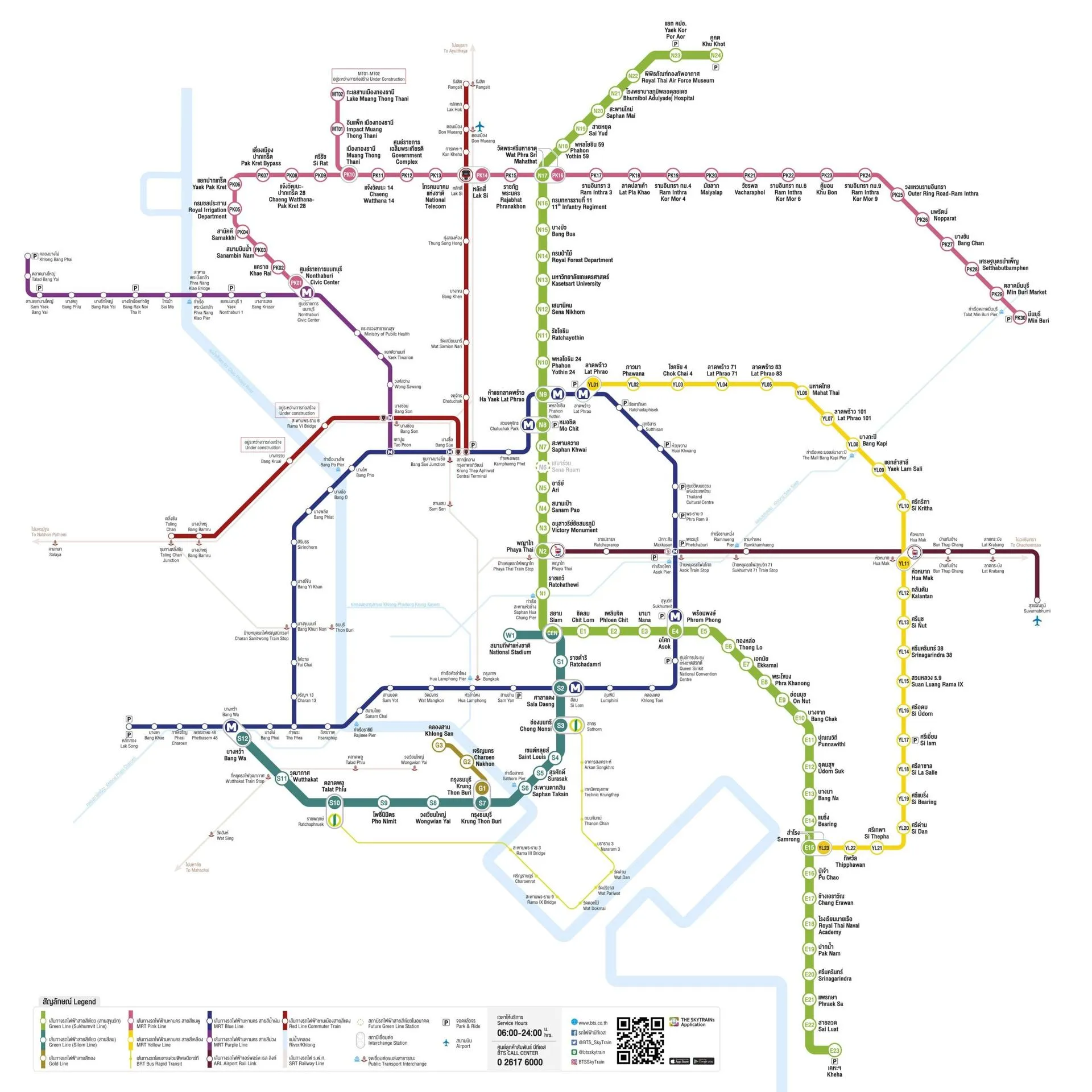
In this guide, we will outline Bangkok’s operational transit lines and explain how different rail systems connect, as well as highlight confirmed extensions and upcoming developments.
Bangkok Mass Transit System (BTS Skytrain)
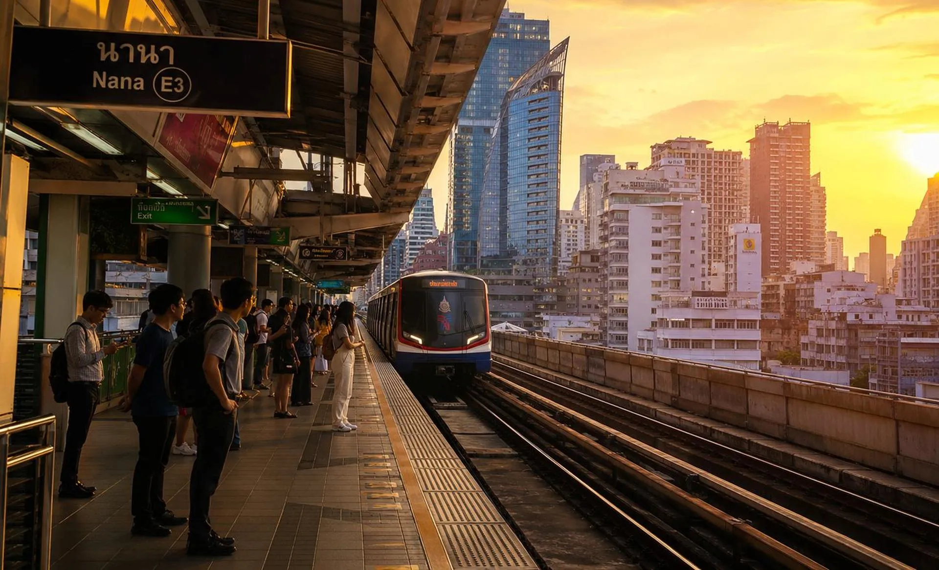
The Bangkok Mass Transit System (BTS Skytrain) is an elevated rail network that operates across both dense commercial and residential areas. It remains a preferred option for daily commuting and travel due to its reliability and direct interchange access to several other transit systems.
Light Green Line (Sukhumvit Line)
The Light Green Line, also known as the Sukhumvit Line, spans 54.25 km with 47 stations and runs from Khu Khot to Kheha. The route covers 3 provinces, including Pathum Thani, Bangkok, and Samut Prakan.
One of its most notable stations, Siam, serves as an interchange between the Light Green and Dark Green Lines and is located within a central commercial and business district that draws high volumes of daily passengers.
- N24 Khu Khot
- N23 Yaek Kor Por Aor
- N22 Royal Thai Air Force Museum
- N21 Bhumibol Adulyadej Hospital
- N20 Saphan Mai
- N19 Sai Yud
- N18 Phahon Yothin 59
- N17 Wat Phra Sri Mahathat (interchanges with the MRT Pink Line’s Wat Phra Sri Mahathat station)
- N16 11th Infantry Regiment
- N15 Bang Bua
- N14 Royal Forest Department
- N13 Kasetsart University
- N12 Sena Nikhom
- N11 Ratchayothin
- N10 Phahon Yothin 24
- N9 Ha Yaek Lat Phrao (interchanges with the MRT Blue Line’s Phahon Yothin station)
- N8 Mo Chit (interchanges with the MRT Blue Line’s Chatuchak Park station)
- N7 Saphan Khwai
- N5 Ari
- N4 Sanam Pao
- N3 Victory Monument
- N2 Phaya Thai (interchanges with the Airport Rail Link’s Phaya Thai station)
- N1 Ratchathewi
- CEN Siam (interchanges with the BTS Dark Green Line’s Siam station)
- E1 Chit Lom
- E2 Phloen Chit
- E3 Nana
- E4 Asok (interchanges with the MRT Blue Line’s Sukhumvit station)
- E5 Phrom Phong
- E6 Thong Lo
- E7 Ekkamai
- E8 Phra Khanong
- E9 On Nut
- E10 Bang Chak
- E11 Punnawithi
- E12 Udom Suk
- E13 Bang Na
- E14 Bearing
- E15 Samrong (interchanges with the MRT Yellow Line’s Samrong station)
- E16 Pu Chao
- E17 Chang Erawan
- E18 Royal Thai Naval Academy
- E19 Pak Nam
- E20 Srinagarindra
- E21 Phraek Sa
- E22 Sai Luat
- E23 Kheha
Dark Green Line (Silom Line)
The Dark Green Line, also known as the Silom Line, spans 14 km with 14 stations and runs from the National Stadium to Bang Wa. It also includes the Siam station, which provides direct interchange access to the Light Green Line.
- W1 National Stadium
- CEN Siam (interchanges with the BTS Light Green Line’s Siam station)
- S1 Ratchadamri
- S2 Sala Daeng (interchanges with the MRT Blue Line’s Silom station)
- S3 Chong Nonsi
- S4 Saint Louis
- S5 Surasak
- S6 Saphan Taksin
- S7 Krung Thon Buri (interchanges with the BTS Gold Line’s Krung Thon Buri station)
- S8 Wongwian Yai
- S9 Pho Nimit
- S10 Talat Phlu
- S11 Wutthakat
- S12 Bang Wa (interchanges with the MRT Blue Line’s Bang Wa station)
Gold Line
The Gold Line runs from Krung Thon Buri to Khlong San. It is a short route that functions as a feeder line for those needing to access riverside commercial areas and nearby mixed-use developments.
The project was originally proposed by the developers of the ICONSIAM mall—Siam Piwat in partnership with CP Group and MQDC—as a dedicated route to the mall. The developers also financed the construction and currently hold a 30-year concession period for both operational and advertising revenue.
- G1 Krung Thon Buri (interchanges with the BTS Dark Green Line’s Krung Thon Buri station)
- G2 Charoen Nakhon
- G3 Khlong San
Mass Rapid Transit (MRT)
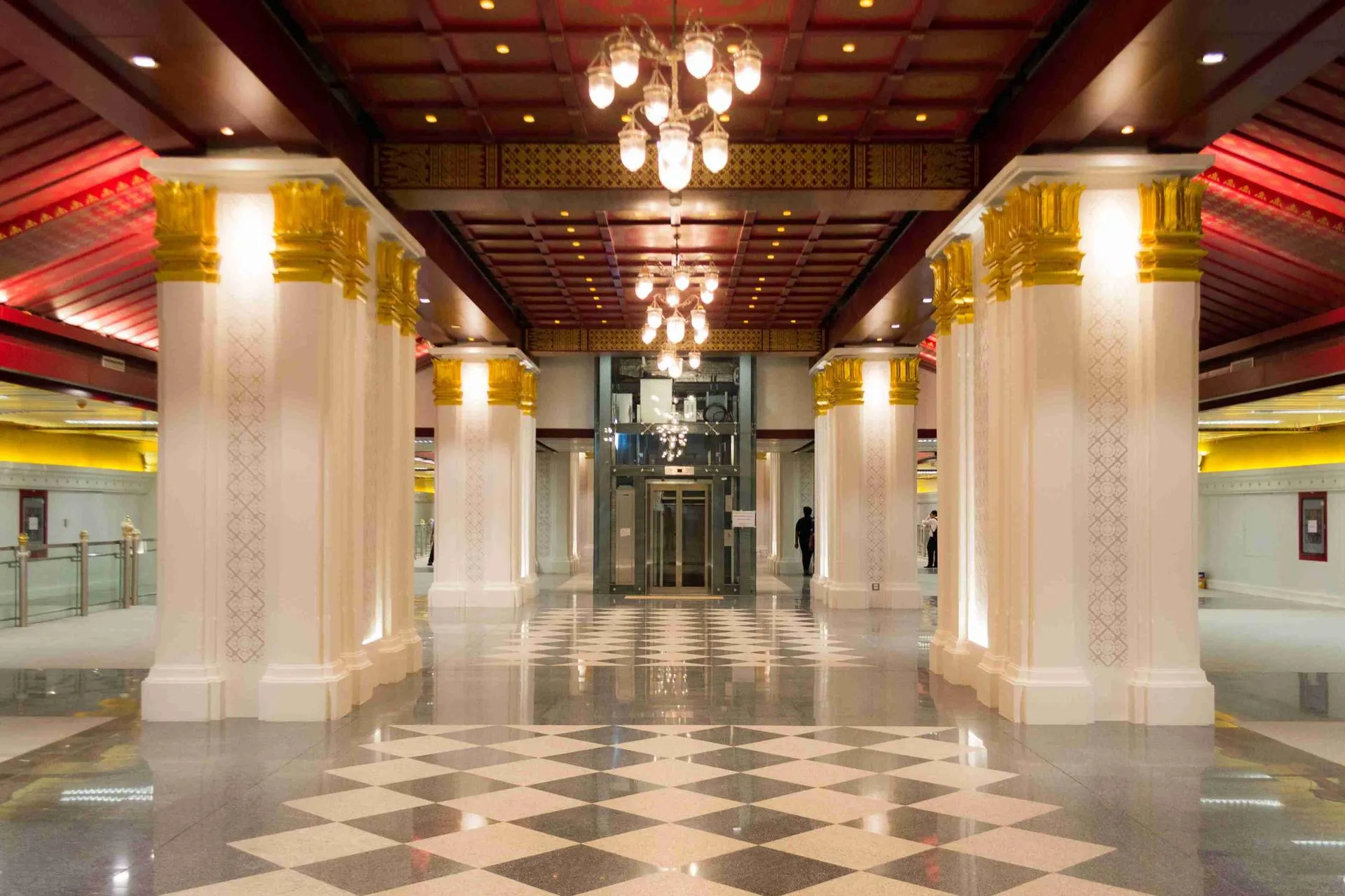
Managed by the Mass Rapid Transit Authority (MRTA), the Mass Rapid Transit system (MRT) operates both underground and on elevated rails, supporting cross-city travel beyond the BTS network.
Blue Line
The Blue Line spans 48 km with 38 stations and runs from Tha Phra to Lak Song. As it also provides frequent interchanges with BTS lines and other MRT routes, it has become one of the most used rail services in the city for both daily commuting and inner-city travel.
- BL01 Tha Phra
- BL02 Charan 13
- BL03 Fai Chai
- BL04 Bang Khun Non
- BL05 Bang Yi Khan
- BL06 Sirindhorn
- BL07 Bang Phlat
- BL08 Bang O
- BL09 Bang Pho
- BL10 Tao Poon (interchanges with the MRT Purple Line’s Tao Poon station)
- BL11 Bang Sue
- BL12 Kamphaeng Phet
- BL13 Chatuchak Park (interchanges with the BTS Light Green Line’s Mo Chit station)
- BL14 Phahon Yothin (interchanges with the BTS Light Green Line’s Ha Yaek Lat Phrao station)
- BL15 Lat Phrao (interchanges with the MRT Yellow Line’s Lat Phrao station)
- BL16 Ratchadaphisek
- BL17 Sutthisan
- BL18 Huai Khwang
- BL19 Thailand Cultural Centre
- BL20 Phra Ram 9
- BL21 Phetchaburi (interchanges with the Airport Rail Link’s Makkasan station)
- BL22 Sukhumvit (interchanges with the BTS Light Green Line’s Asok station)
- BL23 Queen Sirikit National Convention Centre
- BL24 Khlong Toei
- BL25 Lumphini
- BL26 Si Lom (interchanges with the BTS Dark Green Line’s Sala Daeng station)
- BL27 Sam Yan
- BL28 Hua Lamphong
- BL29 Wat Mangkon
- BL30 Sam Yot
- BL31 Sanam Chai
- BL32 Itsaraphap
- BL33 Bang Phai
- BL34 Bang Wa (interchanges with the BTS Dark Green Line’s Bang Wa station)
- BL35 Phetkasem 48
- BL36 Phasi Charoen
- BL37 Bang Khae
- BL38 Lak Song
Purple Line
The Purple Line spans 23 km with 16 stations and runs from Khlong Bang Phai to Tao Poon, with the entire route serving as a main route between Bangkok’s suburbs and the central transit network.
- PP01 Khlong Bang Phai
- PP02 Talad Bang Yai
- PP03 Sam Yaek Bang Yai
- PP04 Bang Phlu
- PP05 Bang Rak Yai
- PP06 Bang Rak Noi-Tha It
- PP07 Sai Ma
- PP08 Phra Nang Klao Bridge
- PP09 Yaek Nonthaburi 1
- PP10 Bang Krasor
- PP11 Nonthaburi Civic Center (interchanges with the MRT Pink Line’s Nonthaburi Civic Center station)
- PP12 Ministry of Public Health
- PP13 Yaek Tiwanon
- PP14 Wong Sawang
- PP15 Bang Son (interchanges with the SRT Red Line’s Bang Son station)
- PP16 Tao Poon (interchanges with the MRT Blue Line’s Tao Poon station)
Note: The Purple Line South Extension, which is currently under development, will extend service 23.6 km from Tao Poon to Rat Burana and add 17 stations. The route will include Thailand’s deepest MRT tunnel, reaching 41 meters beneath the Chao Phraya River. Expected to open in 2028, the full Purple Line will span 46.6 km and link Nonthaburi, Bangkok, and Samut Prakan.
Yellow Line
The Yellow Line spans approximately 30.4 km with 23 stations, operating as a monorail system between Lat Phrao and Samrong. The route provides east-west travel services across the city and functions as a feeder line to several other transit systems in Bangkok.
- YL01 Lat Phrao (interchanges with the MRT Blue Line’s Lat Phrao station)
- YL02 Phawana
- YL03 Chok Chai 4
- YL04 Lat Phrao 71
- YL05 Lat Phrao 83
- YL06 Mahat Thai
- YL07 Lat Phrao 101
- YL08 Bang Kapi
- YL09 Yaek Lam Sali
- YL10 Si Kritha
- YL11 Hua Mak (interchanges with the Airport Rail Link’s Hua Mak station)
- YL12 Kalan Tan
- YL13 Si Nut
- YL14 Srinagarindra 38
- YL15 Suan Luang Rama IX
- YL16 Si Udom
- YL17 Si Iam
- YL18 Si La Salle
- YL19 Si Bearing
- YL20 Si Dan
- YL21 Si Thepha
- YL22 Thipphawan
- YL23 Samrong (interchanges with the BTS Light Green Line’s Samrong station)
Pink Line
The Pink Line spans approximately 34.5 km with 30 stations and operates as a straddle monorail between Nonthaburi Civic Center and Min Buri, following a similar model to the Yellow Line.
- PK01 Nonthaburi Civic Center (interchanges with the MRT Purple Line’s Nonthaburi Civic Center station)
- PK02 Khae Rai
- PK03 Sanambin Nam
- PK04 Samakkhi
- PK05 Royal Irrigation Department
- PK06 Yaek Pak Kret
- PK07 Pak Kret Bypass
- PK08 Chaeng Watthana-Pak Kret 28
- PK09 Si Rat
- PK10 Muang Thong Thani
- MT01 Impact Muang Thong Thani
- MT02 Lake Muang Thong Thani
- PK11 Chaeng Watthana 14
- PK12 Government Complex
- PK13 National Telecom
- PK14 Lak Si (interchanges with the SRT Red Line’s Lak Si station)
- PK15 Rajabhat Phranakhon
- PK16 Wat Phra Sri Mahathat (interchanges with the BTS Light Green Line’s Wat Phra Sri Mahathat station)
- PK17 Ram Inthra 3
- PK18 Lat Pla Khao
- PK19 Ram Inthra Kor Mor 4
- PK20 Maiyalap
- PK21 Vatcharaphol
- PK22 Ram Inthra Kor Mor 6
- PK23 Khu Bon
- PK24 Ram Inthra Kor Mor 9
- PK25 Outer Ring Road-Ram Inthra
- PK26 Noppharat
- PK27 Bang Chan
- PK28 Settabut Bamphen
- PK29 Min Buri Market
- PK30 Min Buri
Other MRT Lines
Thailand plans to introduce additional MRT lines to expand rail coverage across underserved areas and support long-term urban growth. The following lines are scheduled for development over the next 4 years:
- The Orange Line, which will span 35.9 km from Bang Khun Non to Min Buri and provide east–west rail service across Bangkok. The eastern section is expected to open in early 2028, while the western section is projected for late 2030.
- The Brown Line, which will span 22.1 km with 20 stations between Khae Rai Intersection and Lam Sali. The route will link with the Purple Line and Pink Line and is expected to open in 2030.
Airport Rail Link (ARL)
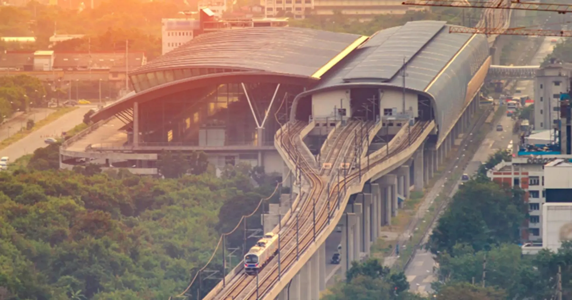
The Airport Rail Link (ARL) is a dedicated rail service that connects central Bangkok with Suvarnabhumi Airport, running between the Phaya Thai and Suvarnabhumi stations. The line spans approximately 29 km with 8 stations.
- A1 Suvarnabhumi
- A2 Lat Krabang
- A3 Ban Thap Chang
- A4 Hua Mak (interchanges with the MRT Yellow Line’s Hua Mak station)
- A5 Ramkhamhaeng
- A6 Makkasan (interchanges with the MRT Blue Line’s Phetchaburi station)
- A7 Ratchaprarop
- A8 Phaya Thai (interchanges with the BTS Light Green Line’s Phaya Thai station)
State Railway of Thailand (SRT)
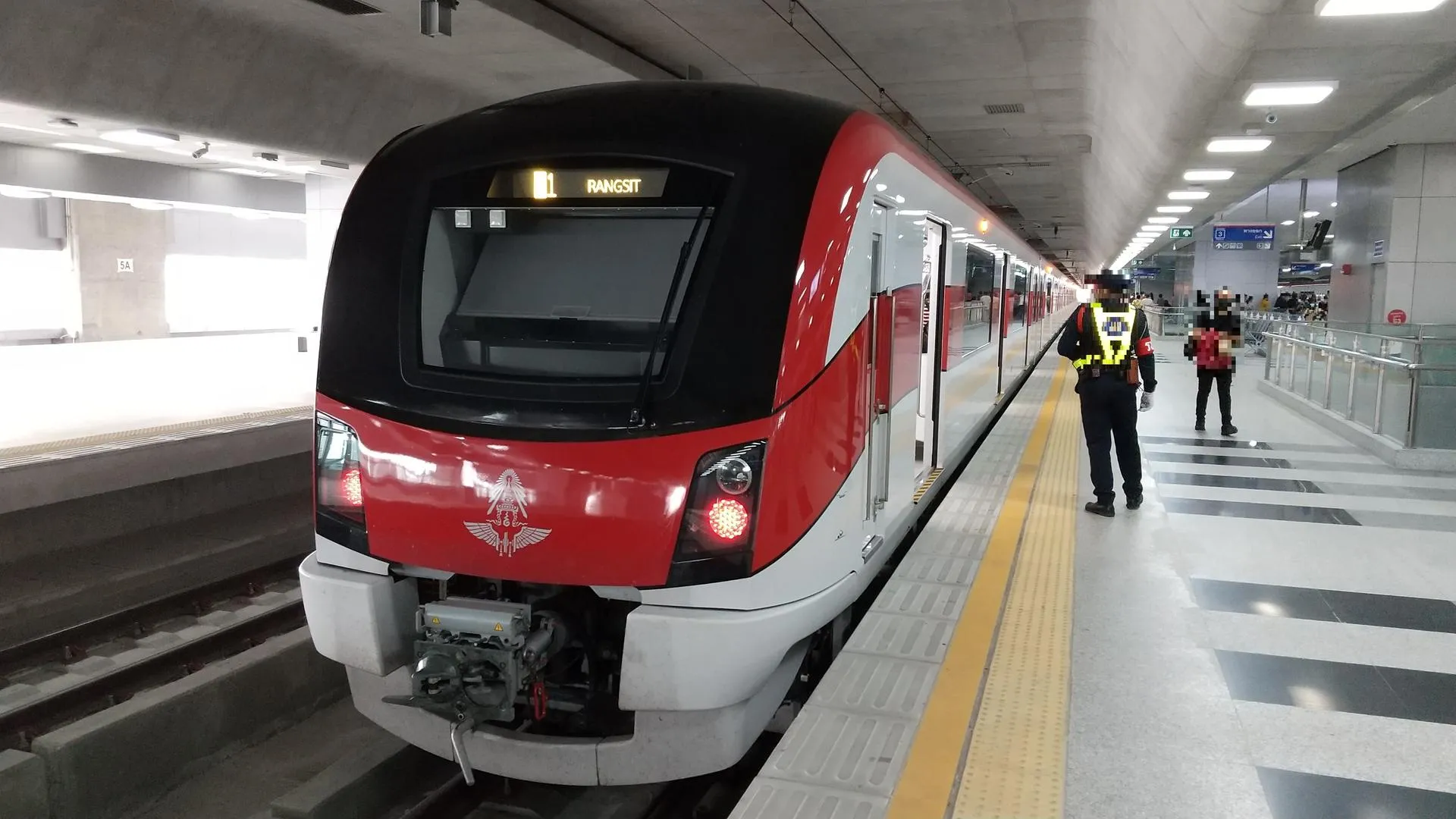
The State Railway of Thailand (SRT) is a suburban rail service designed for longer-distance commuting between Bangkok and surrounding provinces.
Dark Red Line
The Dark Red Line spans 26.3 km with 10 stations and runs from Krung Thep Aphiwat to Rangsit, forming a major northern route that links Bangkok with the rapidly growing suburban areas.
- RN01 Krung Thep Aphiwat (interchanges with the MRT Blue Line’s Bang Sue station)
- RN02 Chatuchak
- RN03 Wat Samian Nari
- RN04 Bang Khen
- RN05 Thung Song Hong
- RN06 Lak Si (interchanges with the MRT Pink Line’s Lak Si station)
- RN07 Kan Kheha
- RN08 Don Mueang
- RN09 Lak Hok
- RN10 Rangsit
Light Red Line
The Light Red Line spans 15.3 km with 4 stations and runs from Krung Thep Aphiwat to Taling Chan. The route functions as a westbound commuter rail service between central Bangkok and the city’s western residential areas.
- RW01 Krung Thep Aphiwat (interchanges with the MRT Blue Line’s Krung Thep Aphiwat station)
- RW02 Bang Son (interchanges with the MRT Purple Line’s Bang Son station)
- RW03 Bang Bumru
- RW04 Taling Chan
How Bangkok’s Transit Systems Impact Real Estate
Bangkok’s expanding rail network shapes residential demand by changing how people choose where to live. Properties near existing and planned rail stations often see higher buyer interest due to easier daily travel and more direct access to commercial and business areas.
Over the coming years, rail access can influence pricing patterns across multiple districts as travel convenience becomes a stronger factor in pricing and demand trends.
Tips for Buying a Property Near a Transit Line
Choosing a property near Bangkok’s rail lines requires paying close attention to the station’s location, line type, and surrounding development patterns, rather than general market trends. The points below can help you evaluate options more effectively without relying on broad assumptions about rail-driven demand:
- Distance to Stations: Properties within a short walking distance of stations often reduce commute time and limit reliance on private vehicles.
- Upcoming Rail Access: Neighborhoods near stations scheduled to open in the coming years may change gradually as new services begin operations, which can lead to significant long-term investment opportunities.
- Explore Different Neighborhoods: When selecting a location, consider how the area functions day to day, including noise levels, density, nearby services, and overall pace of living, and whether these conditions align with your lifestyle.
Explore Property Opportunities Near Bangkok’s Transit Lines
Bangkok’s expanding rail network continues to affect how people live, move, and choose property locations across the city. As new lines open and existing routes expand, rail access becomes more relevant to residential demand patterns and long-term property considerations.
At Sunway Estates, we draw on our local market knowledge to guide clients through Bangkok’s property landscape, with a focus on locations that offer long-term value, including areas with transit access, surrounding infrastructure, and area-specific conditions. Each of our recommendations is carefully reviewed to align with our clients’ lifestyle preferences and long-term investment strategies.
Whether you want to invest in real estate or simply want a smoother daily commute, contact Sunway Estates to explore property opportunities across Bangkok near current and planned transit lines!
Please complete the form. We will get back to you as quickly as possible. Alternatively if you want to visit us please call to arrange an appointment.